


The Obscuring of the Knappaghmanagh Stone
Each one teach one

Some of the great views of Clew Bay emerge while travelling across the drumlins of Knappagh, crossing a ridge to catch a glimpse of the islands and mountains, and the Atlantic stretching out behind them. One of those views comes along the north fork from Lankill, which cuts south of Knappaghbeg Lough and then rises steeply through Lankill crossroads and down into Knappaghmanagh. There, on a sunny day, the sea sparkles to the north of Croagh Patrick.
Knappaghmanagh is a townland about four kilometres south of Westport. The townland is an old division of the land covering a few hundred acres, its origins going back a thousand years and more. Ireland invented the surname, a concept that enabled the collection of church taxes. The first recorded surname in Ireland is from the tenth century: O’Cleirigh, meaning clerk or cleric. (In English, Clark). It was the clerics who assigned the names to the townlands, and many bear the name of monastic settlements or churches from that time. Knappagh means hill: there’s Knappaghmore, the big hill to the south and Knappaghbeg, the small hill to the east.
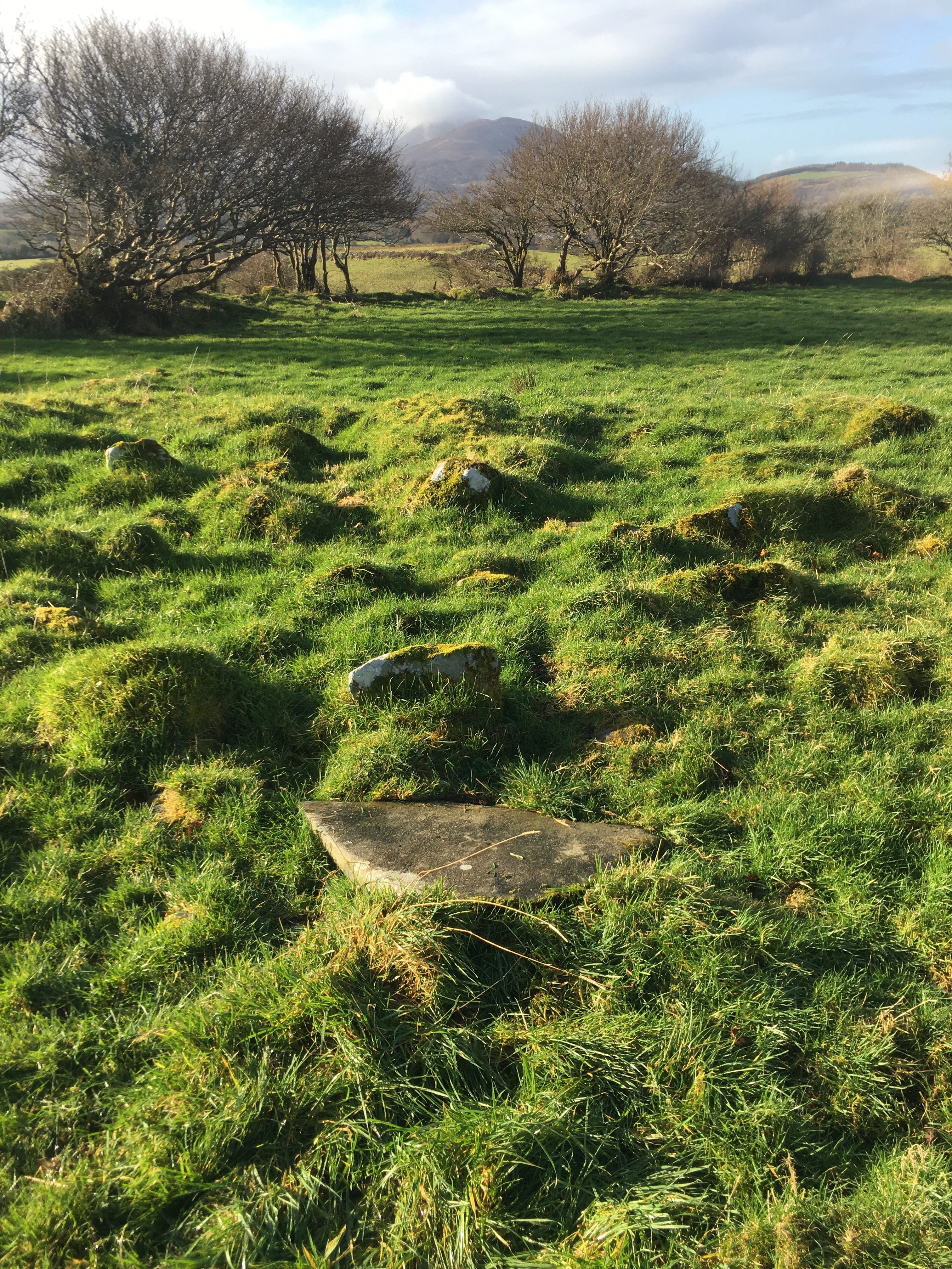
Knappaghmanagh in English translates as hill of the monks, but before that it was one of the sacred places that dotted the pilgrim road. Like the Lankill stone, the Knappaghmanagh cross slab was something I’d once seen in a book, which described it as the Knappaghmanagh stone. Like the Lankill stone, there’s nothing along that road marking to the spot. Yet, wandering that area, you soon realise that this stone is less than a kilometre from the Boheh stone to the west and the Lankill stone to the south. It’s pretty remarkable that three rare and elaborately decorated stones stand within shouting distance of each other. To find the Knappaghmanagh stone, take the western route at the Lankill cross roads and a few hundred metres down the road, keep an eye out for a long curved wall on the left.
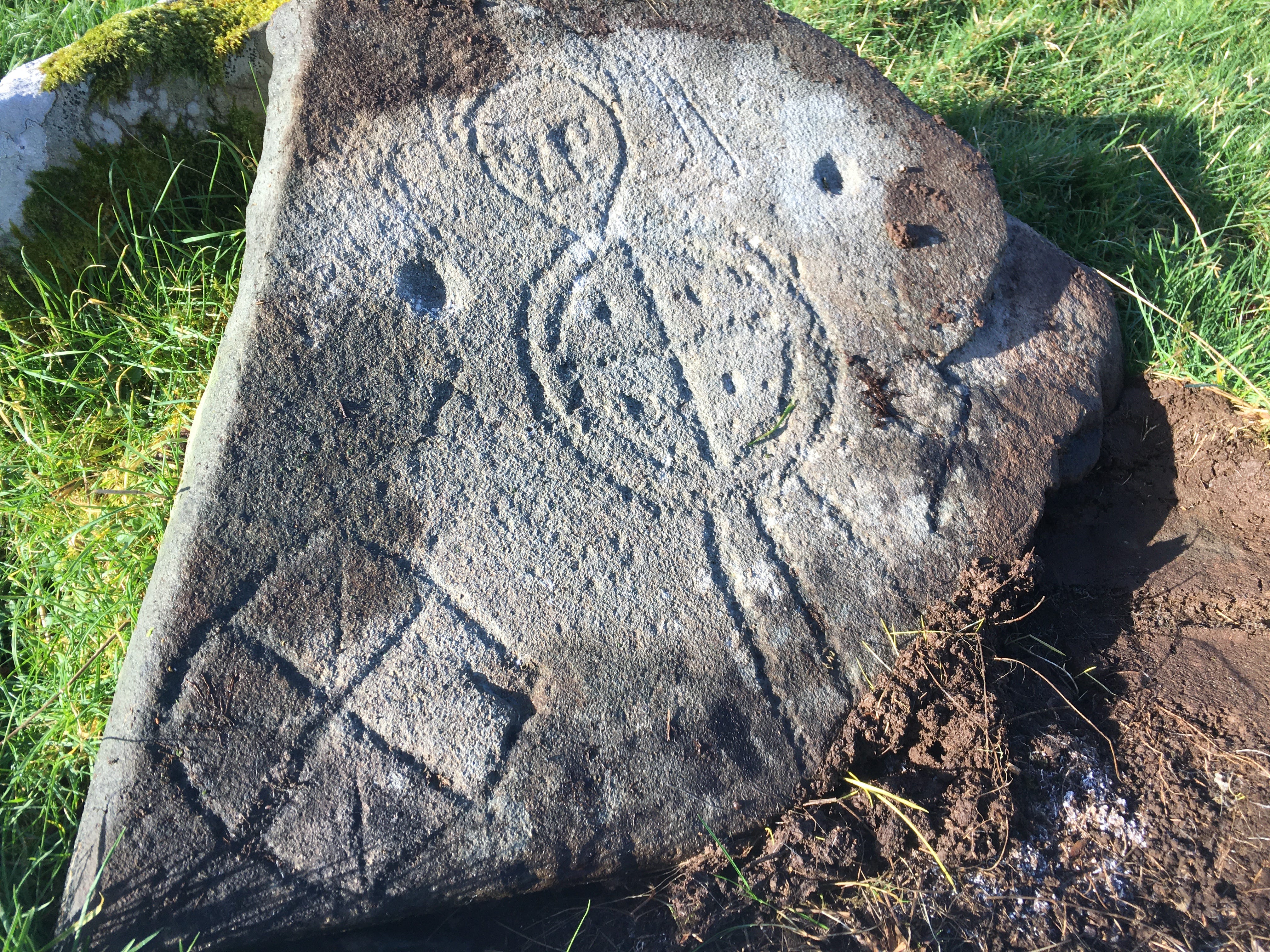
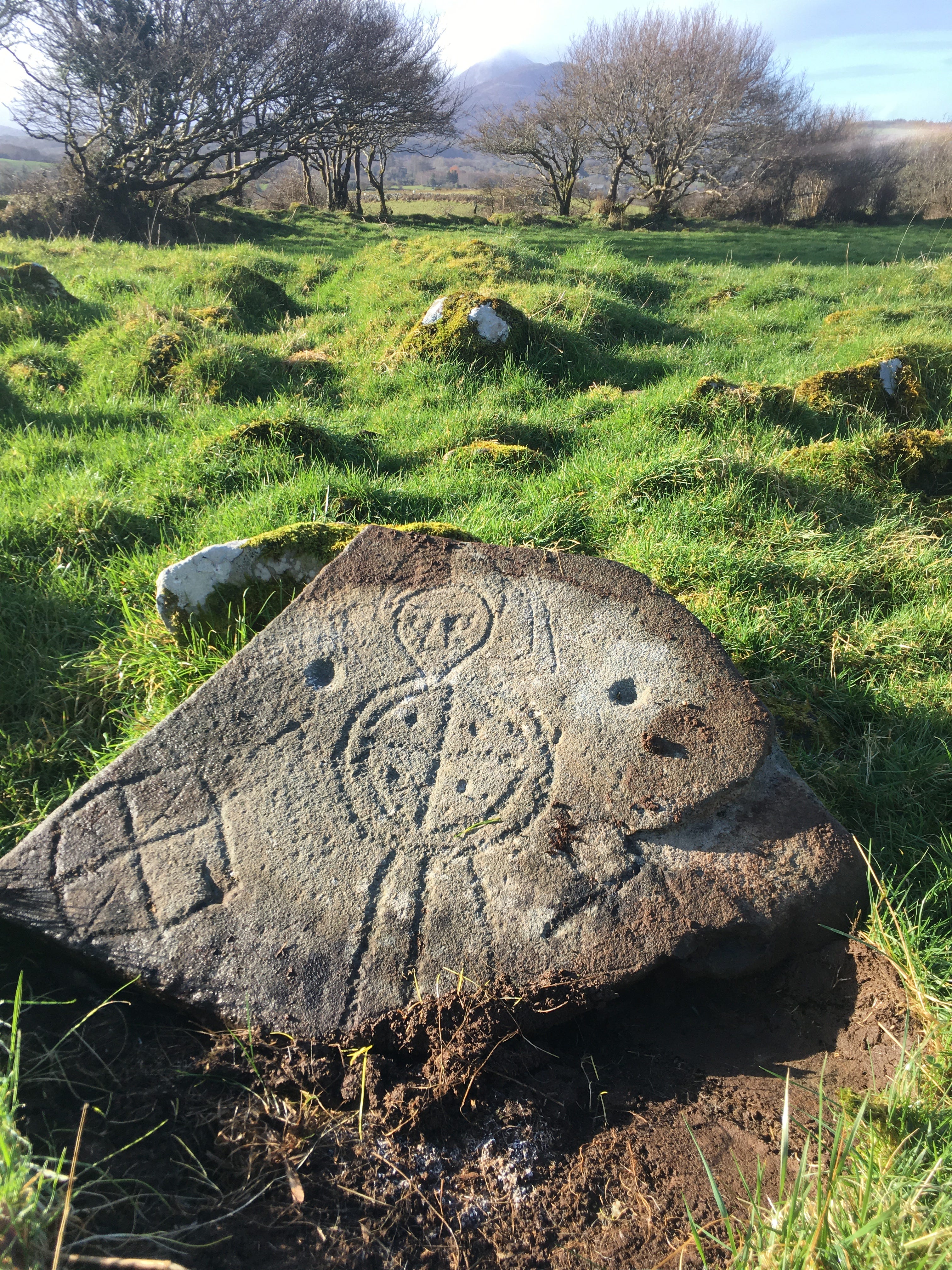
There’s only one place to get over the broad wall, but walk down past some trees and you’ll find a rough circle of low stones. When I visited, I recognised from the photo in the book that it was the right spot, with Croagh Patrick ahead to the west through the trees. I found the centre of the circle but no sign of the cross slab. There was a slab of rock near the centre, but with a smooth surface, and similar in shape to the slab stone. There was a bit of a space on one side where the slab was not sitting flat into the ground. Something told me this was the slab. With some effort, I managed to prise the stone up at its east end, and pushed it upright. The slab eased itself down into its correct position and I stood back and marvel. I couldn’t make out if the figure is wearing a solar hat or seven halos or a beehive on its head. I’d never seen anything like this. It’s got a real spaceman vibe to it, but the longer I looked at the stone, the more it seemed to me that it’s a woman warrior.
This place is sometimes described as a killeen, and is also associated with the burial of unbaptised children, which normally keeps the wary at bay. Toberbrendan, just back the road, has similar associations. Both places lie now obscured by newer myths.
I wondered if someone, or some people, were obscuring this stone? It’s in its rightful place, it seems, but is hidden. Two people can easily lift it into place, and I guess that two people could also spirit it away. I decide it’s not my business to interfere, so I leave it back in place, hidden. Sometimes you need to turn over a few stones to get to the real story.
Thanks for a lovely account of your exploration. I wish I'd read this before I visited there myself about 10 days ago as I was unable to locate the slab stone that day. The main purpose of my trip though was to find any trace there might be of the home place of one of my maternal great-great-great grandparents - and it turns out that in the early-mid1800s, the land my ancestor occupied included this very field, at the southern end of which there appears to be a remnant of the home now repurposed as a sort of livestock pen.
What an amazing story !! I wish I could have been there! :)