

The mystery of the Lankill Long Stone
The mystery of the Lankill Long Stone
It's in its nature

The first time I saw or heard of the Lankill stone was on a visit to the Clew Bay Heritage Centre on Westport Quay. It’s a volunteer-run centre, full of curiosities. In the bottom of a cabinet, there’s a fading photograph of an enigmatic carved stone, with Lankill written in ink on the picture. It’s listed as one of the national monuments in Mayo, with a GPS reference that shows the stone in a field just off the old pilgrimage road.
Along the Tóchar Phádraig from Ballintubber, there are plaques every few hundred metres marking historical and mythological events. One plaque tells you that you’re entering the remains of the old forest, but the Lankill stone gets no mention. The Lankill stone remains largely unrecorded during the last century, apart from the writings of two immigrants to Ireland. One was a short essay written in the 1950s by French lecturer and scholar of Irish megalithic art Françoise Henry, who taught at University College Dublin. After the second world war, she worked on some of the excavations on Inishkea North, off the Mayo coast, and on Glendalough in County Wicklow. In 1952, she published an article about her visit to the Lankill stone in the Journal of the Royal Society of Antiquaries of Ireland.
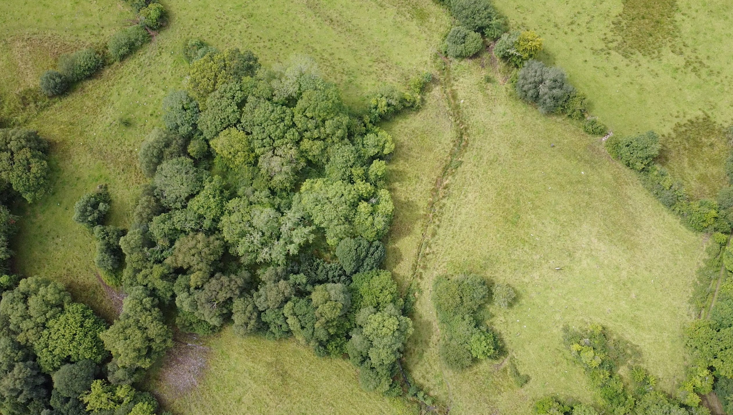
“The townland of Lankill is about four miles south of Westport, a short distance east of a by-road which, branching off the Westport-Leenane road, goes due south towards the Partry Mountains. It is situated among low and not unfertile hills, over the marshy valley of a little stream, is the place known locally as St. Brendan’s Well. The well is a trickle of water at the foot of a big oak tree. Over the fairly deep hollow in which the water collects, there is a white pebble which is used locally for curing the ‘falling sickness’ [epilepsy]. A broken stone basin, cut out of a big block of stone, can be seen in the well itself. The well is under a large knoll rising out of the side of the hill, very steep over the well and the stream, much less impressive on the northern side. Its shape and incline suggest very definitely the appearance of a tumulus of considerable size, but it remains possible that it is only a natural formation.”
She then describes the long stone, revealing her deep knowledge of sacred sites:
“This slab in mentioned in the List of Early Cross Slabs and Pillars of Crawford as a pillar ‘marked with crosses and other designs’. The truth is very much stranger, as the designs on both sides of the stone are broken fragments of a megalithic decoration. They are composed, on the west side, of two groups of arcs within a half-circle, followed by patterns of chevrons, and finally four concentric circles. On the other side are two concentric circles, the top one having only two circles, and the centre being occupied by several vertical lines and a horizontal one.
Both series of designs have very close parallels in the carvings of New Grange or Dowth. The closest resemblance is with the designs on the roofing stone of the right recess of New Grange, which has also chevrons and concentric circles, as well as the same system of twin circles. But a decorated megalith near Westport comes as a surprise. The nearest carvings of the same type known so far would be those of Lough Crew, about a hundred miles to the east. This isolated monument comes as a warning of how little we know of the pre-Christian monuments of the coast of Mayo. The fact that the stone is carved on its two sides also remains to be explained. But the motives, as well as the pocked technique, can leave very little doubt as to the origin of this stone. If the mound be really a tumulus, it was probably found on its outskirts, and may well have been part of a decorated kerb-stone.”
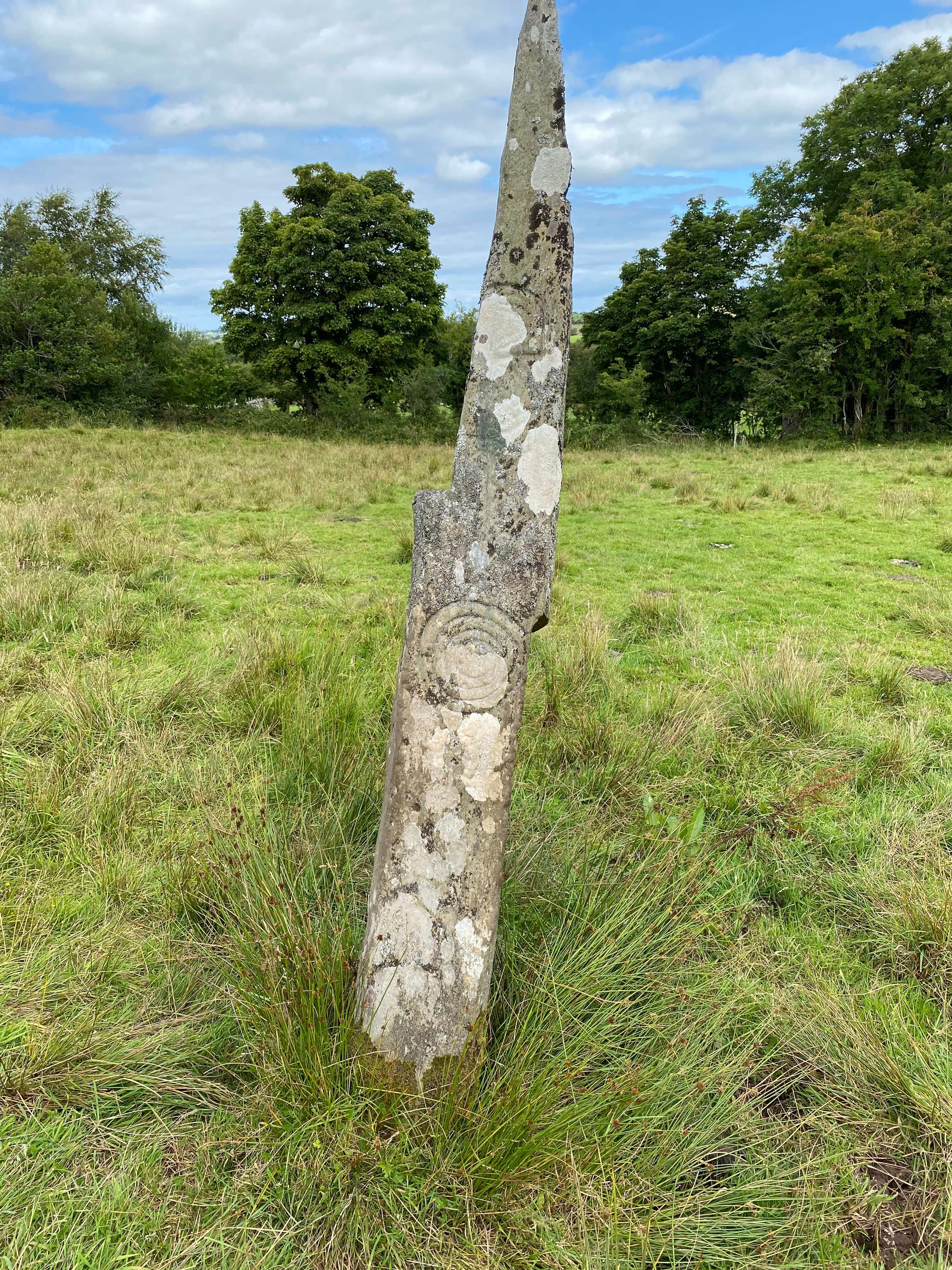
There’s little doubt Henry is correct with her guess, though she surmised incorrectly that the slab or long stone was once a lintel stone in the mound. At the south end of the mound, the stream still bubbles up from the well, Toberbrendan, lately adorned with the name of the saint, and runs out onto the road after hard rain. Henry published two photographs of the long stone, along with sketches she had made. The stone in her picture appears upright, clean and unmarked by lichen, which now cover much of the decorated surface.
Below: Toberbrendan on the left, covered in trees, and the Lankill stone just visible in the field on the right.
If you can find it, you’ll see that it’s now leaning back at a slight angle. From Aghagower, follow the road towards the Lankill crossroads, and 2.5 kilometre along, as you pass through the remaining strip of the old woodlands, you’ll see a gate and a trail to the south through the trees. Follow the trail until the next gate, and cross the field through the gap in the hedge, and you’ll see the Lankill stone ahead.
Henry’s writing remained the best piece of recent history about the Lankill longstone until the Anglo-Indian writer Michael Poynder found his way there around the turn of the millennium. Poynder had dowsing skills little known by other scholars, but certainly known to the builders of the megaliths, and he and his dowsing colleagues found two water flows passing under the stone, along with two magnetic flows, producing a ring of five concentric circles that Poynder mapped out and drew onto a photograph of the stone.
Illustration by Patrick Lynch
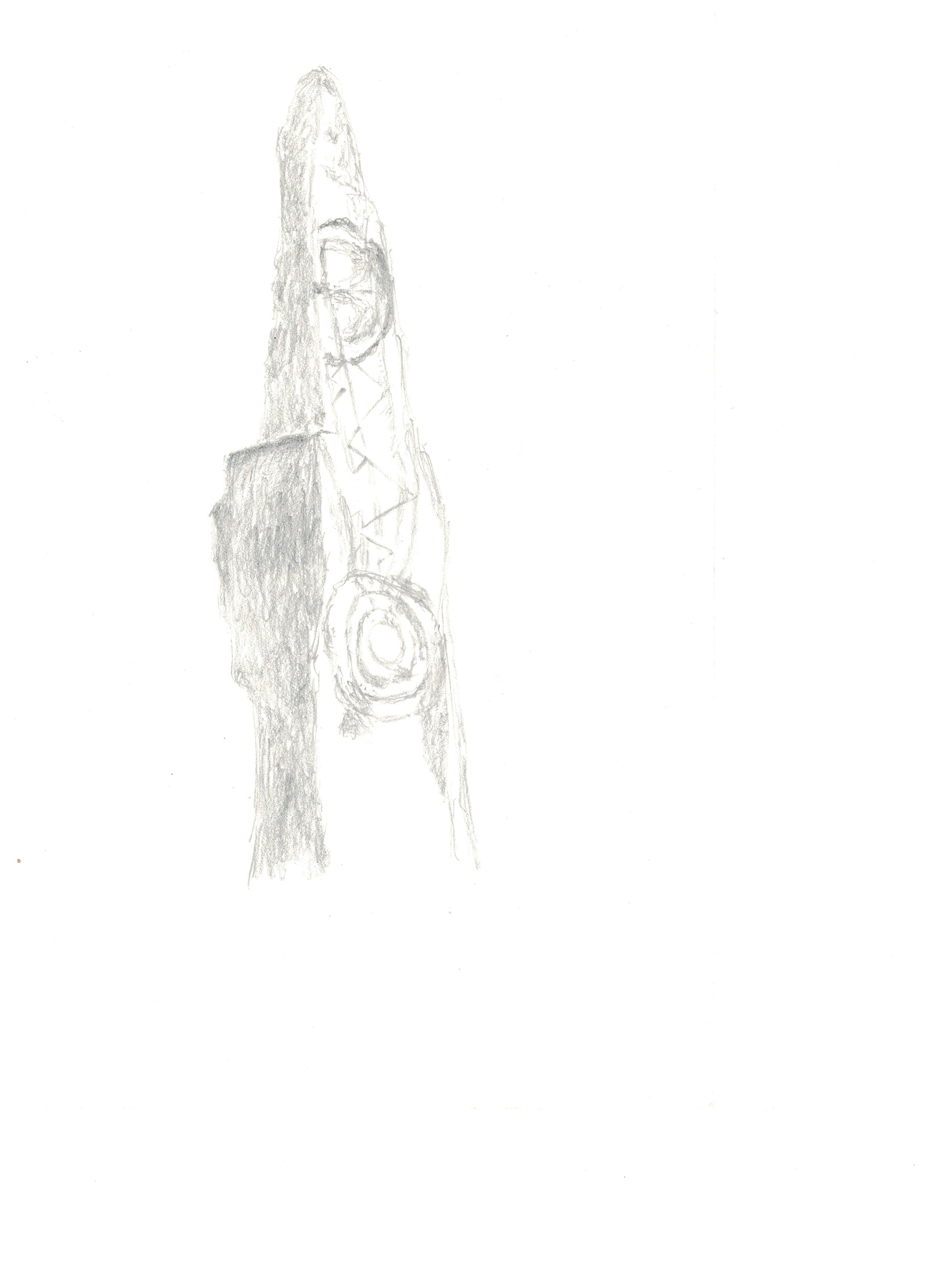
Below is a crossing of water and earth lines, creating the five circles drawn into the stone. The zig-zagging waves of light descend from the solar circles above. This is carved into the Lankill Long Stone on the western face, with another set of rings on the east side. This is not a symbol of anything. It’s a description of its nature.